facebook-pixel

How much of Utah has burned this year? The Tribune put together a map of what that looks like.

The amount of acreage burned in Utah is the equivalent of about 3.5 Zion National Parks, or 2/3 the size of Rhode Island.

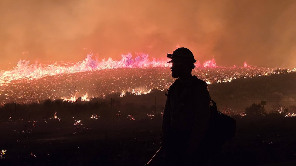
(Utah Fire Info via Facebook) Crews work on the Rocky Canyon Fire in Morgan County in a photograph released Sunday, Aug. 9, 2026.

(Utah Fire Info via Facebook) Crews work on the Rocky Canyon Fire in Morgan County in a photograph released Sunday, Aug. 9, 2026.

Utah is experiencing one of its worst wildfire seasons on record, with more than half a million acres already burned statewide.

As of Monday morning, just over 514,000 acres have burned in 820 fires across the Beehive State, according to Utah Fire Info. Just this weekend, the Rocky Canyon Fire sparked in Morgan County and forced evacuations from White Crossing to East Canyon Dam before the blaze surged to roughly 13,000 acres.

Many of this year’s large fires have been fueled by extreme fire weather, along with drier fuels due to low snowpack from last year’s lackluster winter.

We put together an interactive map so you can see how Utah’s burn scar compares to Salt Lake City, Zion National Park, Park City Mountain Resort and the State of Rhode Island. The map combines the total burned acreage in Utah and overlays it onto the locations of other sites.

Support free news for Utah

sltrib.com is now free to access — no subscription required. We made this decision because we believe access to trustworthy, independent news shouldn’t depend on what you can afford — especially as misinformation and AI-generated content continue to rise.

Free to read doesn’t mean free to produce. Our reporters show up every day to ask hard questions and hold powerful institutions to account. That work takes resources. As a nonprofit newsroom, we rely on support from people who believe it matters. Make a donation today to fund local news that serves Utah communities.

You can help us bring more local news to more communities today.