


This is an archived article that was published on sltrib.com in 2015, and information in the article may be outdated. It is provided only for personal research purposes and may not be reprinted.
It may soon be known as the Great Salt Lakebed.
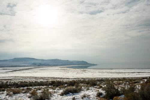
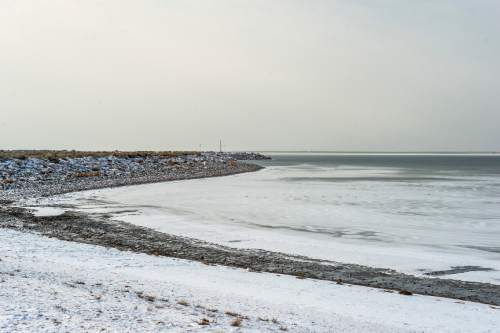
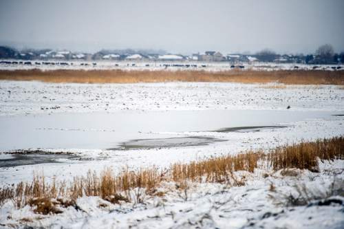
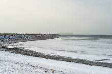
Utah's inland sea continues to lose its vastness, reaching a troubling milestone in recent weeks when the elevation of the Great Salt Lake's North Arm achieved a new historic low of 4,191.6 feet above sea level. This event triggered new protocols designed to protect the lake's ecological health and economic contributions.
Utah land managers will not entertain any new mineral leasing around the lake, and they will crack down on illegal motorized travel across exposed lakebed while fast-tracking approvals for dredging operations, according to Jason Curry of the Division of Forestry, Fire and State Lands (FFSL).
"It is becoming increasingly difficult for [extractive industries] to reach the brine water. One [company] is extending their intake canal. We are still committed to facilitate continued access for the leases currently in place," Curry said.
The moves were initiated under the 391-page Great Salt Lake Comprehensive Management Plan, adopted in 2013 to preserve the lake's many beneficial uses in the face of growing demands on the limited water resources that replenish the lake. The Great Salt Lake sustains economic activity estimated at $1.3 billion and a stopover and nesting ground of "hemispheric importance" to millions of migratory waterfowl.
"A healthy lake means thriving industry, which benefits the state's economy," said Laura Ault, FFSL sovereign lands program manager. "A healthy lake also provides more abundant water resources upstream, flourishing wildlife, recreational opportunities, improved ecosystems and better air quality. We're concerned about low lake levels because it can negatively impact the Wasatch Front's overall health."
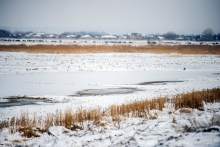
The level of the South Arm, which receives infusions of fresh water from the Bear, Weber and Jordan rivers — not to mention about 90 percent of the discharge from the state's wastewater treatment plants — is about a foot higher than the North Arm. The two are separated by a railroad causeway that was completed in 1959 and was breached in 1984 to relieve flooding on the south.
But now the level is so low that no water moves through the breach, so the lake is effectively two lakes: a hypersaline one to the north and a higher, less-saline one to the south.
Still, the South Arm has hovered about a foot above the historic low set in 1963, a record that could be broken next year, depending on precipitation this winter. Today it rests at 4,192.5 feet, but it could drop once Union Pacific Railroad cuts a new breach through the causeway next spring or summer.
The state recently completed the approvals, and the railroad has begun construction on the 150-foot breach, which will be spanned by a bridge. The project includes berms in the lake bed that would be raised or lowered as needed to adjust flows between the two arms.
Were water able to move through the causeway and equalize the two arms, the South Arm would be about a half-foot lower, according to Cory Angeroth, the chief hydrologist with the U.S. Geological Survey's Utah Water Science Center.
"The South Arm is being held up by the lack of communication between the two arms," he said.
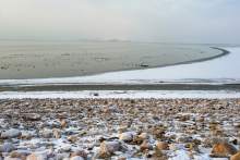
"The lake is unique in that it is so big, yet so shallow, and the bed is really flat. If you drop a foot of elevation, that exposes a lot of lake bed. One thing you have issues with is dust. As the lake gets smaller, it provides less surface area for evaporation, which helps feed into lake effect that we enjoy in the mountains for skiing and water sources."
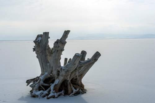
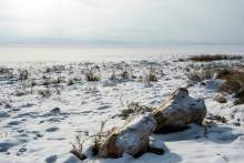
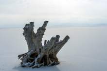
The historic lake bed is now more dry than wet, which some motorized-vehicle enthusiasts misinterpret as an invitation to drive on it, according to Curry. Nearly all of Farmington Bay, formed by Antelope Island and the lake's east shore, is now dessicated. In places, wheel tracks can be seen in Google Earth images, particularly near Goose Island.
Motor vehicles not only cut ruts that take years to erase, but also cause headaches for public safety officials who have to respond to stranded drivers and extract vehicles mired in soft sediments.
"It's lake bed; no motorized use is allowed unless it is posted with signs that indicate it is open," Curry said. "We are getting people stuck out there, and it's a disturbance to waterfowl that we haven't seen before."
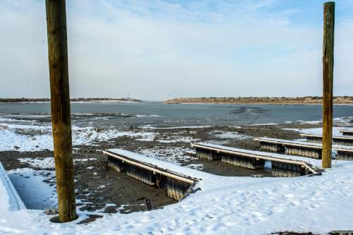
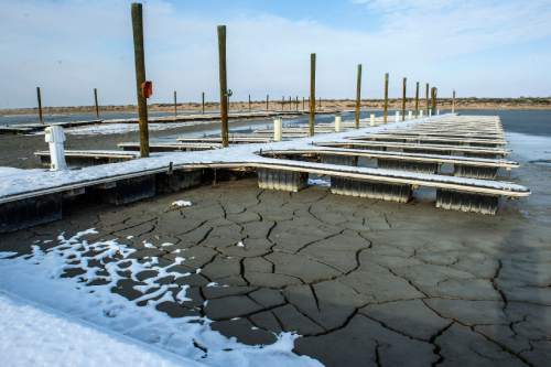
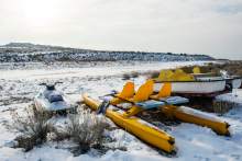
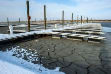
Also in the works is a $1.5 million dredging project needed to rescue the Great Salt Lake Marina that the state operates on the southern shore. Once a haven for sailboats, the marina is nearly empty of keeled watercraft. The Utah Division of State Parks has a dredging plan, but its contractor must first figure out where to dump the spoils dug up from the marina floor. The U.S. Army Corps of Engineers is weighing various options. Its decision could have a big impact on the project's final cost.
The situation at the state marina on Antelope Island is hopeless, with docks sinking into the mud. It is likely going to be years, if ever, before the public will be able to use this marina.
Brian Maffly covers public lands for Salt Lake Tribune. Maffly can be reached at bmaffly@sltrib.com or 801-257-8713. Twitter: @brianmaffly